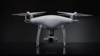
Drone technology has helped the construction industry boost productivity and digitize workflows. The all-new DJI Phantom 4 RTK is the tool that takes construction mapping to a new level. Exceptional surveying deliverables can be achieved thanks to its built-in centimeter-level navigation and positioning system, as well as the high-performance imaging system that supports both RTK and PPK.
Watch how German construction group STRABAG leverages this innovative drone solution to streamline construction surveying workflows, increase efficiency and create detailed 3D models.
Watch STRABAG’s story and read more at https://enterprise-insights.dji.com/user-stories/next-generation-mapping
Resources:
How Accurate is the Phantom 4 RTK? – https://bit.ly/3yenOnM
Why DJI’s Phantom 4 RTK is the Missing Piece in the Drone Surveying Puzzle – https://bit.ly/3zdBfWy
All You Need to Know About Drone Surveying – https://bit.ly/3B9ndpE
Building an AEC & Surveying Drone Program Playbook – https://bit.ly/38eKrxP
Learn More:
Subscribe: https://www.youtube.com/channel/UC9gL…
Like us on Facebook: https://www.facebook.com/DJIEnterpris…
Follow us on Twitter: http://www.twitter.com/DJIEnterprise
Follow us on LinkedIn: https://www.linkedin.com/company/dji/
Website: https://www.dji.com/phantom-4-rtk
Website: http://enterprise.dji.com